
اولین و بزرگترین ارائه کننده محصولات شرکت Garmin
ارائه کننده محصولات گارمین در ایران
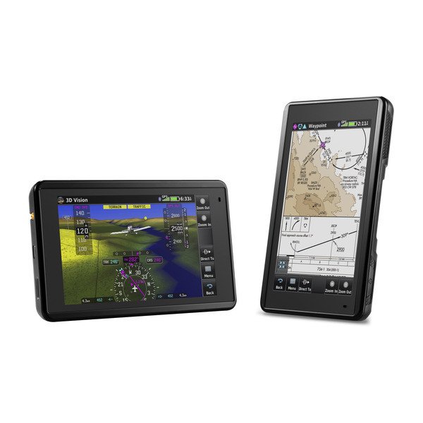
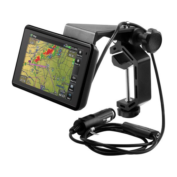
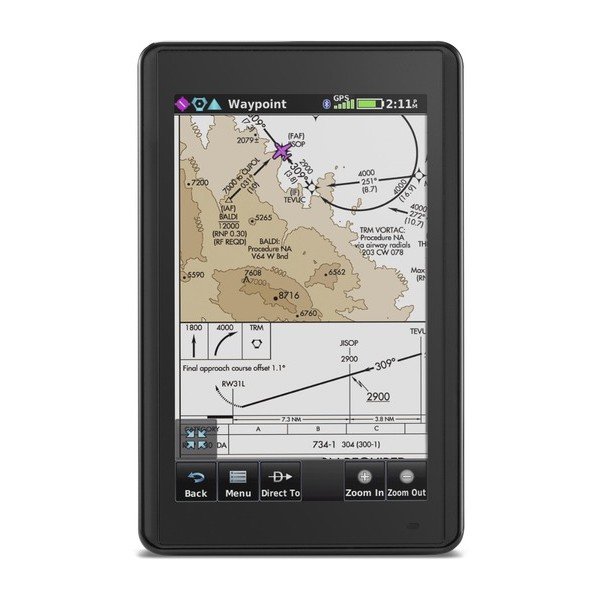
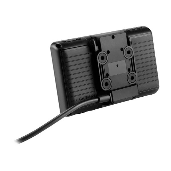
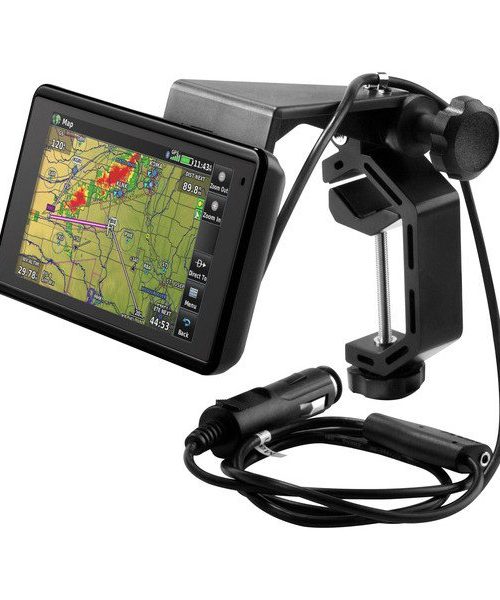
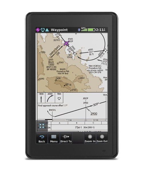
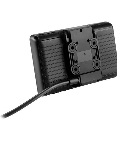
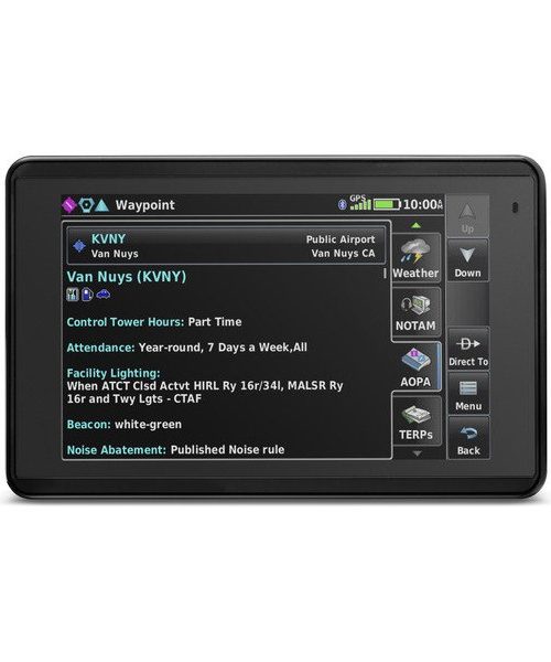
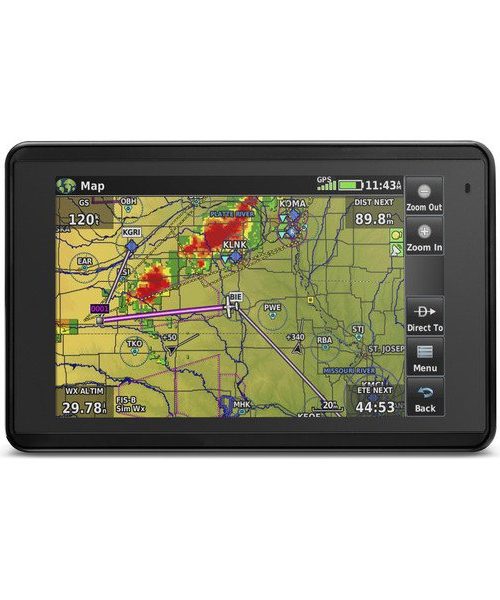
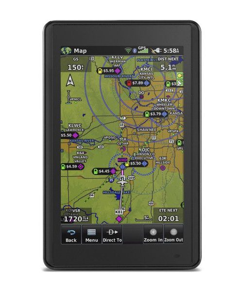
aera® 660
PART NUMBER 010-01518-00
Physical & Performance
- Physical dimensions: 5.5”W x 3.4”H x .8”D (14.1 x 8.7x 2.1 cm)
- Display size, WxH: 4.35″W x 2.61″H (11.1 x 6.6 cm); 5.08″ diag (12.9cm)
- Display resolution, WxH: 480 x 800; portrait and landscape orientation
- Display type: touchscreen WVGA color TFT with white backlight
- Weight: 8.64 ounces (245 g) with battery; 7.23 ounces (205 g) without battery
- Battery: removable, rechargeable lithium-ion
- Battery life:
- Up to 4 hours during most daytime conditions,
- (80% backlight) and wireless connectivity in the cockpit,
- e.g. GTX 345; up to 6 hours during typical nighttime conditions,
- (5% backlight) and without wireless connectivity.
- SBAS/WAAS/GLONASS receiver: high-sensitivity with WAAS position accuracy
- Voltage range: 10-35
- IFR or VFR: VFR
- Traffic Information Services (TIS) alerts compatible: yes
- Accepts data cards: yes (microSD™ cards)
محصولات مرتبط
-
Part Number: 010-02564-03
-
PART NUMBER 010-02804-81
Aviation Features
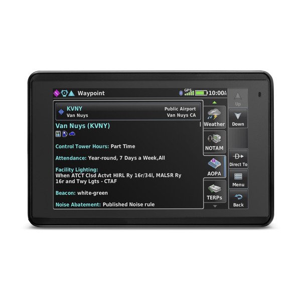
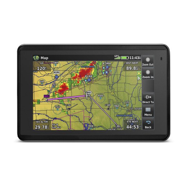
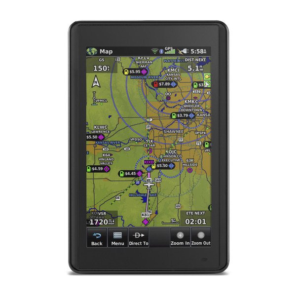
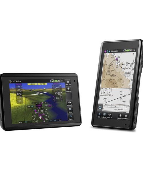
WORLDWIDE AIRPORT DATABASE(S)-ALTIMETER WITH ADJUSTABLE BARO SETTING-3AXIS COMPASS WITH HSI (HORIZONTAL SITUATION INDICATOR)-MULTIPLE TIME ZONES WITH ZULU/UTC-WIRELESSLY RECEIVE FLIGHT PLANS FROM GARMIN PILOT-™NEXRAD ON MOVING MAP-MOVING MAP WITH AVIATION AIRPORTS, NAVAIDS, ROADS, BODIES OF WATER AND MORE-WAYPOINT INFORMATION PAGE-WORLDWIDE NAVAID AND INTERSECTION DATABASE-(S)CONNEXT AVIONICS CONNECTIVITYIN-FLIGHT PULSE OX-AVIATION ALERTS-MOS & METEOGRAM-FLY ACTIVITY EMERGENCY MODE-DENSITY ALTITUDE CALCULATOR-METAR (METEOROLOGICAL AERODROME REPORT)TAF-(TERMINAL AERODROME FORECAST)
-
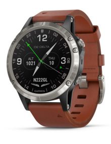
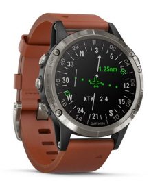
Aviator Watch with Brown Leather Band
Part Number: 010-01988-31
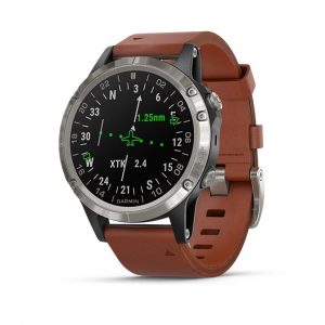
Fly Direct-to or Navigate Flight Plans
Using its built-in worldwide airport database, the D2 Delta aviator watch lets you access our signature Direct-to and Nearest routing functions by simply pressing either of 2 dedicated buttons. So, you can fly straight to the location or waypoint of your choice — or find the nearest airport if you need to land quickly. You can also view your flight path in relation to nearby navaids, airports, intersections and other surface features on the watch’s full-color moving map — or follow the instrument-like HSI course needle to your destination. It’s easy to pan and zoom the moving map to quickly expand your view of airports, waypoints, weather activity and VFR reference features such as roads, cities, bodies of water and more. And by setting your own waypoints, you can navigate to any location not included in the database. In fact, you can even create Mark on Target waypoints to easily reference — and return to — locations over which you’ve flown.
-
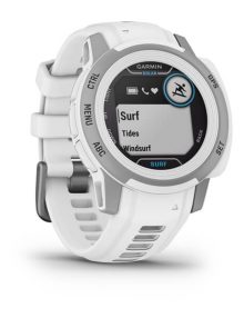
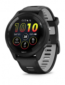
ساعت گارمینForerunner® 265Black Bezel and Case with Black/Powder Gray Silicone Bandمحصول از قبل به علاقه مندی ها اضافه شده! مشاهده لیست علاقه مندی ها
PART NUMBER 010-02810-10
نظرات
هنوز دیدگاهی ارسال نشده است!